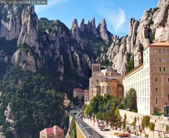
The Patronat de la Muntanya de Montserrat is an autonomous entity of administrative character of the Generalitat, based in the Palau de la Generalitat, attached to the Department of the Presidency. It enjoys legal personality and has its own heritage for the fulfillment of its purposes: it manages the Natural Park and develops other actions of general interest. (Law 10/89). Chapter 1. Articles 2 and 3)
When was it created?
The Montserrat Mountain Board was created by the Decree-Law of 16 October 1950. The reasons for its establishment are based on the religious and cultural importance of the Monastery and the Sanctuary and the beauty and uniqueness of the mountain, which have made this place an international tourist center. In addition, the actions of the public authorities that demand the aforementioned circumstances cannot be carried out by the local entities that distribute the territory of the mountain.
What institutions does it represent?
The Government of Catalonia.
The municipalities of El Bruc, Collbató, Monistrol de Montserrat and Marganell.
The county councils of Anoia, Bages and Baix Llobregat.
The provincial councils of Barcelona, Girona, Lleida and Tarragona.
The central state administration.
The Monastery of Santa Maria de Montserrat.
(Law 10/89). Chapter 1. Article 4)
Which organs does it integrate?
The Presidency, in the role of the President of the Generalitat.
The Vice-Presidency, in the figure of the Abbot Father of the Monastery of Santa Maria de Montserrat.
The plenary.
The Executive Committee.
(Law 10/89). Chapter 3. Articles 10, 11 and 12)
What territory does it act on?
The Board of Trustees exercises its competences within the territory of the mountain of Montserrat, which is delimited as follows:
The description of the limits is made from the westernmost point of the affected area, in the direction of clock rotation, following the map numbering order.
The starting point is Castellferran or Castell de la Guàrdia, which has the following geographical coordinates, extracted from sheet 391 II (e 1:25.000) from the map of the National Geographic Institute (Vol. photogrammetric 1973, 1st. edition, 1985): latitude 41' 36' 45' and longitude 1' 45' 52' and is included in the UTM CG 970075 quadrant.
From Castellferran it continues in the N direction (CG 970084) to gradually descend to the Marganell stream (CG 976089 and CG 980092) and from there ascend to Malniu (CG 986094). From this point it enters the municipality of Marganell by the path of Ca l’Oliver, where it continues in the direction E, crossing the hills of the different mountain ranges that suddenly descend on the stream of Marganell and the torrents of Oliver and Casot to the place of the same name (CG 995096 and DG 002099).
From here it descends towards the SE until it finds the dividing line of the municipal terms of Castellbell and Vilar i Marganell (DG 005096), and follows it until it finds the Riu-Sec stream (DG 027089), where the term of Castellbell i Vilar finds dividing line with the Monistrol de Montserrat, where it descends in NE direction to the height of 220m (DG 030090).
From this point it enters the municipality of Monistrol de Montserrat, where it continues towards the SE, framing the passage of the Tortuguer stream to the Piteu mountain (DG 033087 and DG 035086) and from here to the Monistrol road to the Monastery in kilometer 7 (DG 032080), in the edge with the Can Franc mountain range; follow the road to the Mentita 0330 before the corosa
From this point on, it roughly maintains the abovementioned level and the Monistrol slaughterhouse (DG 041067) reaches the path; it goes down to the Martorell to Manresa county road, on the right bank of the Llobregat river (DG 043066), and continues in the S direction to the Salut hermitage in the torrent of the same name (DG 050032). It continues upstream of the aforementioned stream, bordering the Collbató hill (DG 024030), where it follows the delimitation with the urban space (DG 018031). Take NW direction following the path from Collbató to Vinya Nova, where it enters the municipality of El Bruc (DG 011038 and DG 007045).
Continue in a straight line above the Can Pèfol plains (DG 002044) and climb slightly to Can Jorba (DG 000048); head along the Castle path in NW direction to the swamp of the Tambor and Paller streams (CG 990052); continue at the foot of the mountain (DG 987053) towards the Bruc de Dalt to the Corral (DG 979052), and Continue in the N direction following the Bruc road towards Can Maçana, and by the gas station and the Creus Verdes (CG 972064 and CG 972075) closes at Castellferran, the starting point of the description.
web site : https://muntanyamontserrat.gencat.cat/ca/inici/

